Get 3DTested's best news and in-depth reviews, straight to your inbox.
You are now subscribed
Your newsletter sign-up was successful
An account already exists for this email address, please log in.
Subscribe to our newsletter
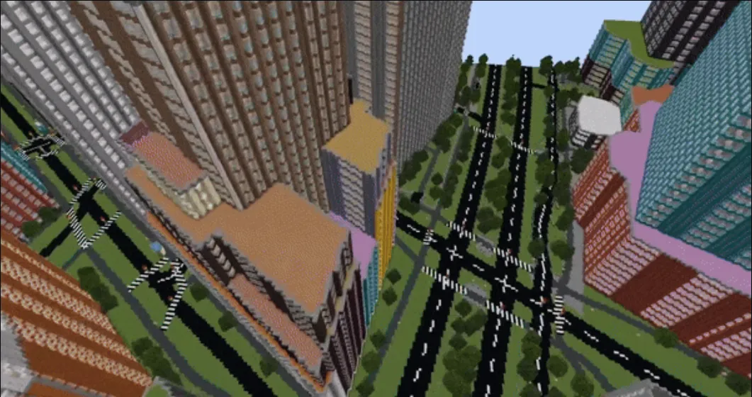
Today, Hacker News brought an interesting new Minecraft world-generation tool to our attention. Arnis uses free geospatial data from OpenStreetMap to generate detailed Minecraft maps based on a specified real-world location. As the developer notes, this tool was initially written in Python. However, the project has since converted to the Rust programming language to learn more about it and utilize its optimization potential. Rust apparently allows for "even better performance and efficiency" than Python.
The name "Arnis" is also derived from the city of the same name in Germany. This is because the city was used to test and debug the algorithm, and its small size made it "an ideal test case" for development purposes. The name being an Easter egg related to the development process is nifty, but there's nothing deeper about it besides that.
As it turns out, there are some precedents for projects like this, even within Minecraft. For example, "Minecraft a la carte" was also developed by the French public institute IGN, which functions similarly. Unlike Arnis, though, it isn't based solely on OpenStreetMap data. IGN (International Institute of Geographic and Forestry Information) also uses its map data in France. In contrast, Wallonia uses Wallonia Public Service (SPW) map data, and locations outside these areas fall back on Bing and OpenStreetMap.
Article continues below
Of course, "Minecraft a la carte" is a government-made solution that requires access to private data that a typical open-source developer doesn't have. Arnis and other projects (which utilize real-world map data for gameplay) made by independent developers almost always use OpenStreetMap since it's free to use, even for these purposes.
One particularly insightful comment in the Hacker News thread also points toward Arnis's limitations. A user reports that their apartment complex isn't rendered within Arnis but only in surrounding areas. That's because OpenStreetMap renders their complex with a "multi polygon" rather than the sets of nodes used for surrounding areas. It would seem, then, that Arnis's ability to utilize OpenStreetMap data with complete accuracy and clarity is still limited in some crucial ways that may not initially be intuitive to its users.
Overall, it looks like Arnis is meeting its laid-out project objectives. If you aren't in an area dense with "multi polygons" on OpenStreetMap, you likely won't have any issue rendering your city or hometown within Arnis and Minecraft.
For more innocuous missing details that Arnis can't do yet, like the most minute street-level details and building interiors, Minecraft is still Minecraft. Flexing your creativity to enhance these generated maps and create something more cool and immersive will likely appeal to people who enjoy this game and other sandbox-friendly titles like it.
Stay On the Cutting Edge: Get the 3DTested Newsletter
Get 3DTested's best news and in-depth reviews, straight to your inbox.